


Pont du Tarn 2

fb30
User
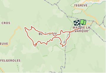

Length
17.6 km

Max alt
1451 m

Uphill gradient
227 m
Km-Effort
21 km

Min alt
1325 m

Downhill gradient
231 m
Boucle
Yes
Creation date :
2021-07-03 07:47:12.0
Updated on :
2021-07-04 07:58:56.559
2h23
Difficulty : Easy

FREE GPS app for hiking
 SityTrail
IGN / Geographical institutes
SityTrail Plus
The world is yours!
About
Trail Mountain bike of 17.6 km to be discovered at Occitania, Lozère, Pont de Montvert - Sud Mont Lozère. This trail is proposed by fb30.
Positioning
Country:
France
Region :
Occitania
Department/Province :
Lozère
Municipality :
Pont de Montvert - Sud Mont Lozère
Location:
Le Pont-de-Montvert
Start:(Dec)
Start:(UTM)
569470 ; 4915168 (31T) N.
Comments